Argentina Part IV:
The Northwest and Surrealistic Landscapes:
(1 to 28 February 2010)
Our saga continues with a trip into Chile looking for a shipping company to take our Mercedes back to the USA, followed by a survey of the Argentine northwest.
After discussing things with Gary and Karla, we decide that in order to spend more time in Argentina we should ship our cars back to the United States. We pick Chile as the most logical place to book the ship. We take a one week trip to the port of Valparaiso to look for shipping companies. Our drive takes us back to the Pan-American Highway (Ruta 7) through the Paso de la Cumbre. The road passes Cerro Aconcagua (in Argentina), the highest mountain in the Western Hemisphere (Figures 1). The pass goes by the ski resort at Los Penitentes in Argentina (Figure 2). This is the major crossing from Argentina into Chile (Figure 3). It is a relatively gentle slope on the Argentine side (Figure 4), while the Chilean side is quite steep (Figure 5). On 3 February we camp just downhill from the summit (Figure 6).
Figure 1. Cerro Aconcagua (snow capped in background) on Argentina Ruta 7.
Figure 2. The Ski Resort of Los Penitentes at 2580 m on Ruta 7.
Figure 3. Paso de la Cumbre from Argentina to Chile.
Figure 4. Paso de la Cumbre on Ruta 7 Argentina.
Figure 5. Paso de la Cumbre on the Chilean side, you can count 11 of the 31 switchbacks.

Figure 6. Our camp just below the summit at Paso de la Cumbre.
We drive past Santiago to the port of Valparaiso (Figure 7). We find two relatively helpful shipping agents/companies. One is a shipping broker, the Bloom Group. The other is a shipping company, Seaboard Marine. Both give us relatively equal shipping quotes.
Figure 7. The port Valparaiso on 3 February 2010.
We stay in the area for several days at a nice campground just south of Valparaiso in Laguna Verde (Figure 8 to 10).
Figure 8. The small town of Laguna Verde south of Valparaiso.
Figure 9. Our camp at Camping Los Olivos in Laguna Verde.
Figure 10. The bay at Laguna Verde.
After we make arrangements to ship the cars, we take a an extra day at Parque National La Compana (Figure 11 to 14). This is one of the places where Charles Darwin visited in 1835.
Figure 11. Parque Nacional La Compana noted for its stands of Chilean Palms.
Figure 12. We have a good dinner at camp in La Compana.
Figure 13. We come all this way to see California Valley quail.
Figure 14. We see several small rodents known as degus (Octodon degus).
We return to Argentina 9 February 2010, and drive north past San Juan to Parque Provincial Ischigualasto (Figure 15). The scenery here, and in all of northwestern Argentina is incredible. It reminds me of many of the areas in the western US, but it is much more extensive. In Ischigualasto we get our first taste (Figures 16 to
Figure 15. Ischigualasto begins our entry into the surrealistic world of northwest Argentina.
Figure 16. The Gusano (worm) in Ischigualasto.
Figure 17. Conning towers of the Submarine.
Figure 18. Valle Pintado (painted valley).
Once again we are on Ruta 40 that traverses Argentina, north to south, for over 5000 km (Figure 19). We pass many roadside shrines along the way. Some are for the martyred Gauchito Antonio Gil (Figure 20) who was the Robin Hood of Argentina in the mid 1800’s. Another is for Deolinda (Difunta) Correa (Figure 21) who died in the desert while nursing her baby. The baby survived, and now people live bottles of water in the shrines in her honor. These can be found on every road throughout Argentina.
Figure 19.Ruta 40 in Catamarca Province.
Figure 20. Shrine to Gauchito Antonio Gil.
Figure 21. Shrine to Difunta Correa.
We drive north on Ruta 40 through the small town of Belen. The scenery, again, is fantastic (Figures 22 to 24). When we reach Cafate, we stop for several days to taste the wines of the region (see Blog: Argentina Part III). Cafayate is getting ready for the wine festival. Some local artists prepare a mural of the event (Figures 26 & 27). At the same time, the indigenous peoples, Kallchaki, hold their own festival (Figures 28 & 29).
Figure 22. Landscape on Ruta 40 north of Belen.
Figure 23. Cactus flower along Ruta 40.
Figure 24. Burrowing parrots along Ruta 40.
Figure 25. Ruta 40 north of Belen.
Figure 26. Cafayate local people prepare a Mural for the wine festival.
Figure 27. A local helps prepare the Mural.
Figure 28. The People of Comunidad Kallchaki hold a festival.
Figure 29. Colorful costum of the Kallchaki.
Just north of Cafayate, on Ruta 68, is a beautiful canyon, Quebrada de Cafayate on the Rio Conchas. We take an afternoon to view the sights (Figures 30 to 35).
Figure 30. Rock formation along the Rio Conchas.
Figure 31. Rock formation called El Sapo (the toad).
Figure 32. Narrow canyon of the Amphitheater.
Figure 33. Rock layers of the Amphitheater.
Figure 34. Sandstone cliffs with burrows of the burrowing parrot.
Figure 35. Look close a burrowing parrot.
\
We continue north of Caffayate on Ruta 40 through some spectacular landscapes (Figures 36 to 38).
Figure 36. Landscape north of Cafayte on Ruta 40.
Figure 37. Another scene north of Cafayate on Ruta 40.
Figure 38. Kilometer 4400 on Ruta 40.
Along the way we see a variety of adobe structures (Figures 39 to 41).
Figure 39. Adobe house with hornero (outdoor oven) to bake bread.
Figure 40. The adobe may look abandoned but it isn't.
Figure 41. This adobe has been transformed into a hosteria (hotel).
In the small town of Seclantás, we watch a man weave a rug (Figure 42). We buy one of his works.
Figure 42. Weaver making a rug out of sheep wool in Seclantis.
On our way to Salta, we pass through Parque Nacional Los Cardones. The park name comes from the large cardone cactus that is prominent (Figure 43 & 44). We miss the big bloom of some flowers by a week or so (Figure 45). Other flowers are more prevalent (Figures 46 to 48). On our way down from the high elevation of Parque Nacional Los Cardones (over 3200 m), we do see some other wildlife (Figure 49 & 50).
Figure 43. Parque Nacional Los Cardones.
Figure 44. Sharon next to a Cardone.
Figure 45. Yellow lily in Los Cardones.
Figure 46. Another yellow flower.
Figure 47. This flower looks like a poppy of some kind.
Figure 48. Another flower, I need a botanist along on this trip (Rod you should have come with us).
Figure 49. Black breasted Buzzard Eagle.
Figure 50. Andean flicker.
We finally reach the city of Salta where we stay for several nights. We take in a Peña (Folklore or Gaucho Show) in one of the tourist spots (Figures 51 & 52).
Figure 51. Peña at La Estacion in Salta.
Figure 52. Peña with folksingers and gaucho dancers.
We decide to drive north to see the Puna (high grassland) in the northern-most parts of Argentina. The Puna is much more extensive in Peru, Bolivia and northern Chile. We drive to Ruta 52, then head west toward the Chilean border. We pass through a large salina (salt flat) called Salinas Grandes (Figure 53 & 54). Ruta 52 goes through some spectacular scenery (Figures 55 to 58). Ruta 52 crosses Ruta 40 at an elevation of 3400m (Figure 59).
Figure 53. Sharon and Mercede on Salinas Grandes.
Figure 54. Salinas Grandes extends for many kilometers in all Cardinal directions.
Figure 55. Ruta 52 goes over a pass, at 4170 m, before Salina Grandes.
Figure 56. Ruta 52 climbs the eastern slope of the Andes.
Figure 57. Puna along Ruta 52.
Figure 58. Puna hillside along Ruta 52.
Figure 59. Ruta 40 where it meets Ruta 52 in Jujuy Province.
The road also allows us to see some interesting animals and plants (Figures 60 to 67).
Figure 60. A lesser rhea in the Puna.
Figure 61. After a rain, I find a toad hopping around in the Puna.
Figure 62. Vicuña in the Puna.
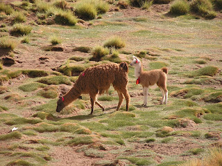
Figure 63. Domesticated llama are common in the northern Andes.
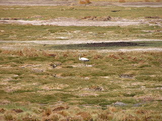
Figure 64. A white Andean flamingo, it must not be eating the right stuff.
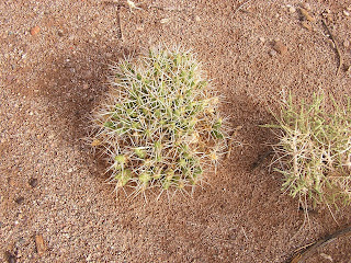
Figure 65. A cactus on the Puna.
Figure 66. Another cactus on the Puna.
Figure 67. Bunch grass cropped by vicuña in the Puna.
On our way back to Salta, we stop in the small town of Purmamarca. It is known for its beautifully colored hills (Figures 68 to 70).
Figure 68. Cerro de los Siete Colores (Hill of Seven Colors) at Purmamarca.
Figure 69. Another view Cerro de los Siete Colores at Purmamarca.
Figure 70. More Cerro de los Siete Colores at Purmamarca.
On 21 February, in Purmamarca, we say our goodbyes to Gary and Karla. They are going to spend another two months before shipping, and plan to visit eastern Argentina (hot, humid) and Iguaçu Falls. We want to head south through Córdoba and back to the Lake District before going into Chile.
Figure 71. The Las Americas Team on our last night together.
We drive south to spend a few nights in Salta, then head southeast toward Córdoba. We spend the rest of February in Córdoba. We have just heard about the devastating 8.8 earthquake that hit Chile. Our hearts go out to the people of Chile.
Again, I am surprised at the size and diversity of Argentina. There will have to be a Part V before we leave.


+on+Argentina+Ruta+7..JPG)


+in+Ischigualasto..JPG)

..JPG)


..JPG)


+to+bake+bread..JPG)

..JPG)


+at+Purmamarca..JPG)


