Part 1: Patagonia - Bariloche to Ushuaia and Return
We arrived in Bariloche in time to locate boarding for Ewok -- before checking into Club Hotel Cerro Catedral for the holiday season. The crossing from Chile into Argentina went smoothly. While in the Bariloche area we also stayed at El Yieti (camped), Camping Petunia (Cabañas) and Hotel Cerro Catedral. We were surprised by how helpful everyone was -- such as, the guy who gave us a boarding recommendation for Ewok, the wonderful Bariloche vets, Juan keeping Ewok in his garden and inviting us to Xmas Eve dinner at Puerto Petunia Restaurant, Alejo – the great chief at Puerto Petunia -- and the list goes on.
After 12 days we left delightful Bariloche and began the drive south on Ruta 40. Our travels south took us to Epuyen (Hosteria Del Lago in a rustic cabana), Parque Nacional Los Alerces (camped), Gobernador Costa (Hotel Roca), Telken Estancia (camped), La Angostura Estancia (camped), El Calafate (Los Dos Pinos Cabanas) where we spent New Years and visted Parque Nacional Los Glaciares. Then it was onto Chilean Patagonia (Parque Nacional Torres Del Paine and Punta Arenas). We crossed into Tierra Del Feugo via ferry from Punta Arenas to Provenir, Chile then after a short drive (100km) on ripio (gravel road) we crossed back into Argentina. Then onto to Rio Grande (Refugio Camping Club Nautica where we meet lots of exciting travelers (on bikes, kayaks, etc.) and our final destination Ushuaia (camped at Pisto Club Andino). This completed our Deadhorse, Alaska to Tierra Del Fuego Journey.
After 2 days in Ushuaia we returned to Punta Arenas, Chile for 6 days to receive treatment for Ewok’s cancer from caring Dr. Tatiana Lopez; then back into Argentina via Ruta 3 (camped at Peurto Julian) then back onto Ruta 40 stopping only at Gobernador Costa (Hotel Roca) and then back to Bariloche (El Yeti and Bungalows Milaquen) where our beloved Ewok died on Jan 18. We will miss her.
During our road trip through Argentina we encountered red flags, votive offerings and other items at roadside shrines. We initially thought the shrines were memorials to people killed along the roadside. Later, I discovered that the shrines pay homage to Antonio Gil (also know as “Gauchito Gil” or “El Gauchito”) who is regarded as a Robin Hood type figure by many.
Also in our travels, we saw bottles of water at certain points along the roadside – were they bottles of water for bikers or??? They were in fact part of Disfunta Correa shrines. Legend has it that during the civil wars of 1840’s Deolinda Correa followed the movements of her husband’s battalion on foot through the deserts of San Juan. When her meager supplies ran out she died with their baby son in her arms. When passing muleteers found them the baby was still nursing. This is the first of miracles attributed to her. At her shrines throughout Argentina you will see bottles of water left to quench her thirst. Truckers are especially devoted and if they borrow water they return it to the site later. Other than water there are other offerings left; at some shrines there may even be enough parts to build a car.
Part 2: The Provinces of Mendoza, San Juan, Rioja and Catamarca
On Jan 21 we headed north again on scenic Ruta 40 towards Argentina’s wine region. Enroute we stopped at Junin de Los Andes (camped at Laura Vacuna), Choas Malal (Muncipal Campground) and Valle Grande, near San Rafael (Camping Los Sauces). Instead of stopping first in Mendoza we headed first to San Juan wine region (San Juan (Hotel Alkazar & Apart Hotel Rocio), Barreal (Posada Don Eduardo) and Pismanta (Hotel Termas de Pismanta). Later we went to Mendoza (Sheraton Mendoza: Pet Friendly) to visit some of the Viñas.
After a quick trip to Chile via Portillo Pass (Ruta 7) through the Andes to check out shipping options for the SUV we returned to Aparthotel Rocio in San Juan. San Juan is a very friendly city to explore. We headed north again on Ruta 40 stopping at San Augustin de Valle Fertil (Camping Valle Fertil), Rioja (Camping Los Pinos), Belen (Camping),
(See the I-Movie posted earlier on wine districts of Chile and Argentina and John's section on Argentian Wines.)
Part 3: Provinces of Salta, JuJuy, Santiago del Estero
The drive through Salta and JuJuy Provinces was a totally awesome experience where we experienced colorful grandiose landscape. We enjoyed discovering Cafayate (Camping Rio Colorado) another great wine region. Then it was onto Molinos where we took another ripio detour to visit Finca Colomé (camping) to sample more wines. From Colomé it was onto Cachi (Camping Municipal) and Salta (Hotel La Beltraneja - pet friendly and wonderful staff). From Salta we drove north on Ruta 9 to JuJuy and then onto Ruta 52 to Puma de Jama. We stopped at Pastos Chicos (camped) and Purmamarca (Hosteria Bebo Vilte). We retraced our journey to return to Salta (Hotel La Beltraneja) where we continued to explore what Salta has to offer. We found Salta to be an enjoyable, relaxing city to visit.
Our travels next took us through Santiago del Estero (stopping only in Cuidad de Loreto, Hotel Ruta 9).
Part 4: Cordoba, La Pampa and Patagonia (Neuquen)
Codoba Province was delightful. We visited first Cordoba (Aparhotel Bari – pet friendly). While we were in Cordoba we were saddened to hear about the earthquake in Chile. Cordoba had a big city feel; so we were fortunately we explored the beautiful Sierra towns of La Cumbre (Camping El Paso), Villa Carlos Pas (ACA Camping) and Embalse (Camping).
Realizing that our time in South America was getting shorter we decided to head south towards Lake District via La Pampa. La Pampa is close to the stereotypical image most North Americans have of Argentina – grasslands, pampas grass, cattle herding, etc.. Our journey through La Pampa took us to General Acha (Hotel Patagonia), Parque Nacional Lihuel Calel (camping).
It was onto Neuquen where we stopped at Añelo (Hotel Sol de Añelo), Villa de La Angostura (Camping Cullumche & Camping Uniquehue). While traveling through Neuquen we also visited the Familia Schroeder Viña. It was great to be back in the lake distict. We spent four idyllic days in Villa de La Angostura. Leaving Villa de La Angosturia we traveled through an area know as Seite Lagos (seven lakes) where we camped at Camping Lago Falkner. We took a break from the road at San Martin de Los Andes (Villa Pirén & Cabanas Ensueno) before heading to Junin de Los Andes where we would cross back into the Chilean Lake District.
Part 5: Buenos Aires
(To be posted later)
During our travels through Argentina I collected i-photos which resulted in the following i-movies.
I-Movie #1: Patagonia - Bariloche to Ushuaia and Return
I-Movie # 2: The Provinces of Mendoza, San Juan , Rioja and Catamarca
I-Movie # 3: Provinces of Salta, JuJuy, Santiago del Estero,
I-Movie #4: Cordoba, La Pampa and Patagonia (Neuquen)
I-Movie # 5: Buenos Aires
(To be added later)
Sharon and Jack drove overland from Deadhorse, Alaska to Tierra del Fuego, Argentina. The adventure began on June 21, 2009 and takes us onwards.
Wednesday, January 20, 2010
Argentina: Part I
Argentina Part I:
Patagonia to Ushuaia:
(14 December to 8 January 2009)
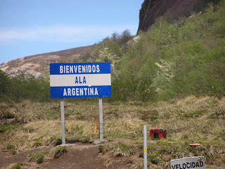
Crossing into Argentina was easier than any border crossing we have experienced. Even the pet paperwork took only 15 minutes. The actual border between Chile and Argentina is in the Andes Mountains (Figure 1 & 2). We drove immediately to San Carlos de Bariloche on the shores of Lago Nahuel Huapi (Figure 3, also called Lago Bariloche).(14 December to 8 January 2009)
Figure 1. The border between Chile and Argentina.
Figure 2. The pass in the Andes between Chile and Argentina.
Figure 3. Lago Nahuel Huapi defines the north side of San Carlos de Bariloche.
We spend the first two days at a nice, but uninteresting, campground a few kilometers west of Bariloche, Camping El Yeti (Figure 4). During these first two days I meet Juan Waroquieres, a fishing guide at Petunia Campground (Figure 5). He talks us into staying at the cabañas at Petunia (Figure 6). The cabañas are nice and have beautiful views (Figure 7). Juan also owns the small but excellent gourmet restaurant, Puerto Petunia (Figure 8).
Figure 4. Our camp at El Yeti.
Figure 5. My fishing guide, Juan, from Fishing Patagonia.
Figure 6. Our cabin at Petunia.
Figure 7. The view from our cabin at Puerto Petunia.
Figure 8. The Restaurant Puerto Petunia.
I hire Juan to take me trout fishing on Lago Nahuel Huapi. I am told by an expert fly fisherman that Juan is probably the best guide in Bariloche. We go for two trips, a couple of hours each on two consecutive days. The first day I catch four trout. The sizes range from 22 inches (about 2 kg, 4.5 lbs) to 24 inches (3 kg, 7 lbs). They are all rainbows, and we keep two (Figures 9 & 10). The second day Juan promises me a German brown trout. We fish for several hours and take two nice rainbows that I release. On our last pass along the north side of Peninsula San Pedro, I get a hit that really bends the rod. It is a 27 inch, 4 kg (about 9 lbs) German brown (Figures 11 & 12).
Figure 9. One of the rainbows I release, it is 22.5 inches.
Figure 10. This one, 24 inches, I keep to have smoked.
Figure 11. German brown trout, I cannot smile because it weighs so much it is hard to hold.
Figure 12. The German brown puts up a good fight.
We spend Christmas in Club Hotel Catedral, the ski resort at Bariloche. Gary and Karla meet us on the 23rd. We have a nice Christmas day dinner of trout, fondue, and Argentine wine (Figures 13 & 14).
Figure 13. Christmas dinner of trout and wine.
Figure 14. Sharon, Karla, and Gary at the fondue pot.
We leave Bariloche on 26 December to head south on famous Ruta 40 through Patagonia. The first night brings us to a small town in Patagonia called Epuyen (Figure 15). We have a nice dinner at Refugio del Lago (Figure 16).
Figure 15. Sharon and John at Lago Epuyen.
Figure 16. Gary, Karla, and Sharon at dinner in Refugio del Lago, Epuyen.
The next day, we enter Parque Nacional Los Alerces (Figure 17). It has stunning Nothofagus (southern beech) forests (Figure 18) and fine fishing, although the rainbows are small (Figure 19).
Figure 17. Parque Nacional Los Alerces.
Figure 18. Gary with fly rod in hand contemplates the southern beech forest at Los Alerces.
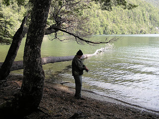
Figure 19. John fishing at Los Alerces, Lago Rivadiva.
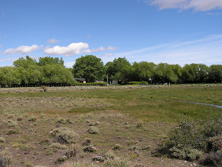
Out of Los Alerces, we take Ruta 40 south in the Province of Chubut (Figure 20). The scenery looks very much like the Great Basin in north central Nevada (Figure 21). The road is paved until Rio Mayo where it turns to ripio (graded dirt) for over 500 km. We camp at two Estancias along the way south. These are working sheep/cattle ranches that also take in tourists. They are quite nice and the views are fantastic (Figures 23 to 26). Wildlife is easy to see on the estancias (Figures 27 to 32).
Figure 20. Sharon and MB on Ruta 40 out of Gobernador Costa.
Figure 21. The landscape along Basin Ruta 40 reminds one of the Great Basin in North America.
Figure 22. Ruta 40 is ripio (dirt) south of Rio Mayo.
Figure 23. Camp at Estancia Telken.
Figure 24. Estancia Tellken.
Figure 25. John at breakfast at Estancia La Angostura.
Figure 26. A view of Estancia la Angostura.
Figure 27. Crested duck at Estancia la Angostura.
Figure 28. Long-tailed meadowlark at Estancia La Angostura.
Figure 29. Black-necked swan at Estancia La Angostura.
Figure 30. Upland goose (male) at Estancia La Angostura.
Figure 31. Guanaco at Estancia Telken.
Figure 32. Lesser Rhea with chicks at Estancia Telken.
The landscape is mesmerizing as we travel Ruta 40 south (Figures 33 to 35). As we approach El Calafate and Glacier Perito Moreno, the landscape becomes more varied (Figures 36 & 37). Glacier Perito Moreno is a real tourist attraction (Figures 38 &39).
Figure 33. Landscape south of Estancia Tellken.
Figure 34. South of Estancia Tellken, Los Andes in the background.
Figure 35. Hills south of Estancia La Angostura.
Figure 36. An iceberg is visible on Lago Argentina. It was probably calved from Glacier Perito Moreno.
Figure 37. Lago Argentina west of El Calafate with Los Andes in the background.
Figure 38. Glacier Perito Moreno.
Figure 39. Glacier Perito Moreno calves.
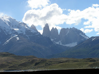
On 2 January 2010 we leave Argentina for Chile (Figure 40). Regardless of the reason, we would have to cross into Chile in any event. This is a short diversion to see Parque Nacional Torres del Paine (Figures 41 to 43). And the park also has some spectacular wildlife (Figures 44 to 49).
Figure 40. Chilean border with Argentina, the only way into Torres del Paine (and Tierra del Fuego) without boating or flying.
Figure 41. Part of the reason for the name, "Torres del Paine".
Figure 42. Another reason for the name, Torres del Paine.
Figure 43. Salto Grande (Great Falls) at Torres del Paine.
Figure 44. Patagonian grey fox in Torres del Paine.

Figure 45. Crested cara cara in Torres del Paine.
Figure 46. Andean Condors in Torres del Paine.
Figure 47. Guanacos in Torres del Paine.
Figure 48. White-eared grebe in Torres del Paine.
Figure 49. Flying steamer duck in Torres del Paine.
The road leads south to Puerto Natales and on to Punta Arenas where we camp for two nights (Figure 50) before taking the ferry across the Straights of Magellan (Figures 51 to 53). Of course, once on Tierra del Fuego, we had to cross back into Argentina (Figure 54). Our first night in Tierra del Fuego, we stay in the town of Rio Grande. We find a nice campground at the Club Nautica, which is a kayaking business (Figure 55 & 56). Interestingly, we meet two men from California (one from Santa Cruz) who began their trip on bicycles in 2006. They started in Deadhorse Alaska. It’s a small World.
Figure 50. Camp at Punta Arenas.
Figure 51. The ferry from Punta Arenas to Porvenir across the Straights of Magellan.
Figure 52. Crossing the Straights of Magellan.
Figure 53. The Straights of Magellan with Tierra del Fuego in the background.
Figure 54. The Argentine border in Tierra del Fuego.
Figure 55. Camp at Club Nautica in Rio Grande.
Figure 56. Sharon in the dinning room at Club Nautica.
From Rio Grande we take Ruta 3 south to Ushuaia (Figure 57). We finish the first part of Argentina in Ushuaia. This is our ultimate destination (Figures 58). It is now our objective to return home. The city of Ushuaia is the starting point for most cruises to Antarctica (Figure 59). Our camp is comfortable in Ushuaia (Figures 60 & 61) at coordinates S 54° 48.780’ X W 68° 21.102’. Gary, Karla, Sharon and I celebrate reaching the end of the driving World (Figures 62 & 63). Actually, the road continues on southwest to Lapataia at coordinates S 54° 49.873’ X W 68° 33.875’. One might be able to make the case that the road to Punta Arenas, Chile is as far south as you can drive, since you have to cross an ocean waterway (the Straights of Magellan) to get to Tierra del Fuego.
Figure 57. Tierra del Fuego, Ruta 3 to Ushuaia.
Figure 58. We are at the doorstep to Ushuaia.
Figure 59. Ships in the port at Usuaia.
Figure 60. Ushuaia campground.
Figure 61. Our camp at Ushuaia.
Figure 62. Celebrating reaching our goal with Argentine "champagne" at camp.
Figure 63. Even the car enters the celebration.
The entire trip from Deadhorse to Ushuaia included a total of 20,172 miles (32464 km). Now we will head back north. The Mercedes completed this leg of the trip with one blow-out, a worn universal joint, and one head light replaced.
Argentina Part I: Patagonia is, perhaps, the most interesting segment of our road trip (2345 miles recorded in Argentina and the detour to Torres del Paine). Ushuaia was our destination.
Subscribe to:
Comments (Atom)


+souith+of+Rio+Mayo..JPG)


+at+Estancia+La+Angostura..JPG)


+at+Torres+del+Paine..JPG)


