

Argentina Part V:
A Return to the Lake Region:
(1 to 22 March 2010)
After leaving Córdoba, we drive a short distance to La Cumbre in the Central Sierra. La Cumbre is a small town where we camped for two nights (Figure 1). The second night we had a rain storm that lasted all night, thus the extra tarp over the tent. However, the rain did bring out the birds (Figures 2 to 5).
Figure 1. Camp at La Cumbre.

Figure 2. Unidentified falcon at La Cumbre.

Figure 3. Field Flicker at La Cumbre, it is one the largest flickers I have ever seen.

Figure 4. Great Pampa Finch at La Cumbre.

Figure 5. Spot-winged Pigeon at La Cumbre.

La Cumbre is also a major paragliding area. The World Championships were held here in 2003. While we were at the cliffs there were several paragliders (Figures 6 & 7). The view from the cliffs overlooks a large cut of Pampas (Figure 8).
Figure 6. Paragliders at La Cumbre, one is a passenger. The other is the "pilot".

Figure 7. Paraglider just getting started.

Figure 8. View of the Pampa from near La Cumbre.

We leave La Cumbre, but do not get very far. We stop for two nights in the ACA (Automovil Club de Argentina) Campground at Villa Carlos Paz. The bird life is fantastic (Figures 9 to 14).
Figure 9. Green-barred Woodpecker in campground.

Figure 10. Shiny cowbird at camp.

Figure 11. Brown Cacholote in camp.

Figure 12. Scimitar-billed Woodcreeper.

Figure 13. Monk Parakeet.

Figure 14. Monk Parakeets in nest, they are colonial with up to 50 living in one nest.

We take Ruta 35 south through the province of La Pampa (Figure 15). The region is mostly grasslands, pampas (Figures 16 to 18), but there are a few animals to be seen (Figures 19 to 21).
Figure 15. Ruta 35 traverses most of the province of La Pampa.

Figure 16. Grasslands in La Pampa.

Figure 17. Pampas grass in the pampas.

Figure 18. Ruta 152 goes west through the pampas. The road is lined with mustard.

Figure 19. Back end of an armadillo in the pampas.

Figure 20. Birds of prey are common, but seldom sit still for a photo.

Figure 21. White-faced tree ducks in a roadside pool.

We head west on Ruta 152 which passes the small national park, Parque Nacional Lihué Calel (Figure 22). This a small area of desert scrub in the midst of the pampas. There are interesting plants (Figures 23 to 27) and animals (Figures 28 & 29). This trail leads to a set of rock paintings (Figures 30 to 32).
Figure 22. Entrance to Parque Nacional Lihué Calel.

Figure 23. One of many cactus in the park.

Figure 24. A prickly pear cactus that looks much like the ones we have.

Figure 25. A cactus in flower.

Figure 26. Lichens on granite.

Figure 27. Vegetation along a permanent stream.

Figure 28. Patagonian grey fox.

Figure 29. Male guanaco keeping watch over his harem.

Figure 30. Pinturas (rock paintings) by indigenous people of the area.
+by+indigenous+peopllke+of+the+area..JPG)
Figure 31. Some pinturas are abstract designs.

Figure 32. Other pinturas are of various animals, like this fox.

We finally approach the Lake Region on Ruta 40.and the base of the Andes (Figure 33). We stay for several days in a campground at Villa La Angostura on the north side of Lago Nahuel Huapi (Figure 34). At camp we adopt a young chimango caracara, who begs food from us every morning and evening (Figure 35).
Figure 33. A mountain caracara induicates we are approaching the Andes.

Figure 34. Camp at La Angostura.
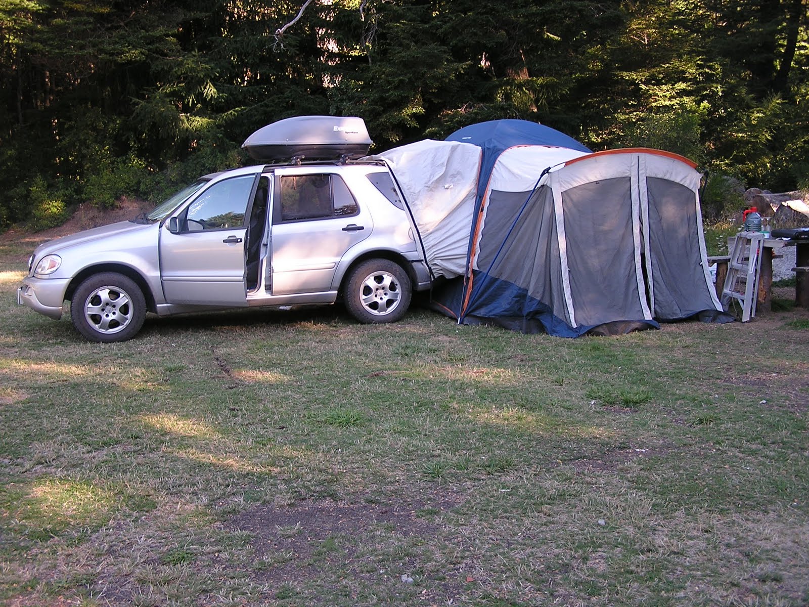
Figure 35. Chimango caracara we nickname Chimi.

While in La Angostura, we take a boat trip to the Parque Nacional Arrayanes which is on a peninsula of Lago Nahuel Huapi (Figures 36 & 37). The park is named for its stand of arrayanes (Luma apiculata) trees. This is one of the few areas where there is a large stand of the trees (Figures 38 & 39). There is also a nice forest of southern beech (Nothofagus dombeyi) (Figure 40).
Figure 36. Sharon on the catamaran to PN Arrayanes.

Figure 37. Shoreline along the peninsula.

Figure 38. Arrayanes trees, notice the unusual bark.

Figure 39. Close up of trunk of an arrayan tree.

Figure 40. Southern beech is the dominant tree in this forest.

We leave via Ruta 234 which is a dirt road that is also called “El Camino de Siete Lagos” (Road of the Seven Lakes). Obviously, it passes by seven lakes, this is one of them (Figure 41). We camp at Lago Falkner (Figures 42 & 43).
Figure 41. Lago Falkner is one of seven lakes we pass.

Figure 42. Sharon studies our route while camped at Lago Falkner.

Figure 43. The mountains above Lago Falkner and our camp.

The small village of San Martin de los Andes lies at the northern end of “El Camino de Siete Lagos” (Figure 44). We stay in a nice complex above the town (Figure 45). The town is famous for its world class ski resort at Chapelco (Figure 46) and for fishing Figure 47 & 48).
Figure 44. The main street in San Martin.

Figure 45. View from our cabin at Villa Pirén above San Martin.

Figure 46. Chapelco Ski Resort a few kilometers south of San Martin.

Figure 47. View of Lago Lacar a favorite fishing lake in the area.

Figure 48. Fly fishing on Rio Malleo.

After a week in San Martin, we head for the Chilean border. We get to see some nice wildlife and scenery on the way (Figures 49 to 55).
Figure 49. Patagonia red fox along Ruta 60 heading to the Chilean border.

Figure 50. A flock of austral parakeets flies overhead on Ruta 60.

Figure 51. Araucaria forest in Parque Nacional Lanin.

Figure 52. Volcan Lanin covered in clouds.

Figure 53. Volcan Lanin seen from Ruta 40 as in Argentina Part III.

Figure 54. Rainbow below Volcan Lanin.

Figure 55. Guacho, horse, and dog on Ruta 60.

We try to cross into Chile at Paso Mamuil Mala (Paso Tromen). The Chilean Agricultural Inspector would not allow us to go into Chile with Amadeus. He said we need more health documentation. We have used the same docs for the past six entries into Chile. This is a very small dirt road crossing, and, I guess the inspector wanted to show he was "in charge". We had no choice but to return to San Martin and get a veterinarian to issue new docs. Now we have to wait until Monday to get the Agricultural agency for Argentina to give us another health document. This has cost us two days travel time, and two night’s hotel. Two days later we cross into Chile (Figure 56). When we did return with the proper documentation, another inspector was not very interested in the paperwork. He just laughed when we told him what the other inspector said.
Figure 56. Crossing into Chile.

Thus, we end our motor trip in Argentina. We were in country for over three and a half months, and recorded over 12,000 miles (19,200 km) in country. This has been an amazing part of our trip. We will return to Buenos Aires after we ship our car from Valparaiso, Chile.
Search Amazon.com for argentina travel guide
bla
ReplyDelete
ReplyDeleteLive 173 視訊聊天
173 Live 視訊-免費聊天室
Live 173免費視訊-聊天交友
Live173視訊影音Live秀
金瓶梅視訊聊天室
0401影音視訊聊天室
UT美女視訊聊天室
momo520影音視訊美女主播聊天室
視訊聊天,影音視訊聊天室,視訊交友
UT台灣辣妹視訊聊天室